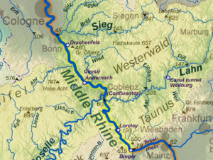
The Rhine is quite a majestic river, flowing from the Swiss Alps, through Germany and the Netherlands, and empties into the North Sea. It stretches over 750 miles, so I’m sure there are other bits along it worth visiting. I currently live along the southern part called ‘Upper Rhine’, where the valley is roughly 20 nautical miles across, so it doesn’t really look like much of a valley. However, north of here, just west of Frankfurt and the city of Mainz, the river slices through a mountain range called the Taunus, and at this point the valley is quite literally as wide as the river with very steep sides. This part is called the ‘Middle Rhine’. It stretches northwest from here almost all the way to Cologne, the upper half of which (aptly called ‘Upper Middle Rhine Valley’, or ‘Rhine Gorge’) reaches from here to about the city of Koblenz, and is on UNESCOs list of world heritage sites. And it has every reason to be, as it is absolutely gorgeous, and littered with medieval castles and forts.
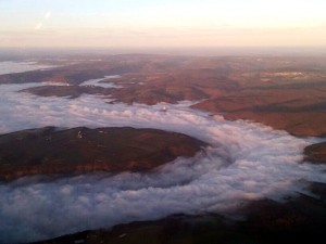
This was in mid January (2014), and it was one of the few days that winter with blue skies and decent visibility below 5000 feet. After a quick touch-and-go in Mainz to extend my 90-day passenger currency, it had been a very poor winter indeed for VFR aviation, we turned northwest to follow the valley. A few minutes in, roughly at the Loreley, all of a sudden the valley turned white as if covered in snow. A closer look revealed it wasn’t snow at all, although it looked all white and puffy, it was fog, and it was stunning.
It was as if someone had taken a still frame of the fog slushing down valley at tremendous speed, and looking at it coming at you it resembled more the picture of water filling up a pipe (imagine your average action movie, the aqueduct scene in “Die Hard with a Vengeance” for example), only it wasn’t moving. Cruising further down the river, or up the river of fog, my friend managed to get a few shots with his phone. The view was absolutely breathtaking.
If you look closely (click through to the larger version for a better view), just above the center of the image, you can see one of the medieval strongholds sitting on a hill top, just poking out of the river of fog.
As we reached Koblenz, the sun was setting, and — since we had a bit of a tailwind coming here — I figured we better turn around and head home or we wouldn’t make it before the airport gets closed. Most airports in Germany are day VFR only, and close at 30 minutes after sunset, not because they don’t have runway lights (some do, my home field does), but open airports must be staffed in Germany, and if you want them to keep it open at night, you usually have to pay (a lot) extra for that service. I don’t have a night VFR rating (it’s not included in your certificate here), so it wouldn’t be legal for me anyway. We would end up cutting it close, but I used a little more power in cruise than I normally do, and we landed with ten minutes to spare.
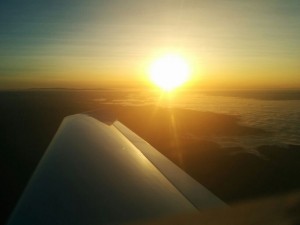
Koblenz is also where the Moselle river joins the Rhine, just as we had turned around heading back south, my friend snapped this splendid picture of the sun setting into the equally fogged over Moselle valley. The Moselle valley is also a very elegant part of the earth, and the Koblenz-Winningen airport sits beautifully right on the edge looking down on it, but that’s a topic for a different post.
I’m grateful that phones nowadays produce such high quality photos.
Filed under Places to Fly
Tagged: germany


Subscribe to comments with RSS.
Comments have been closed for this post